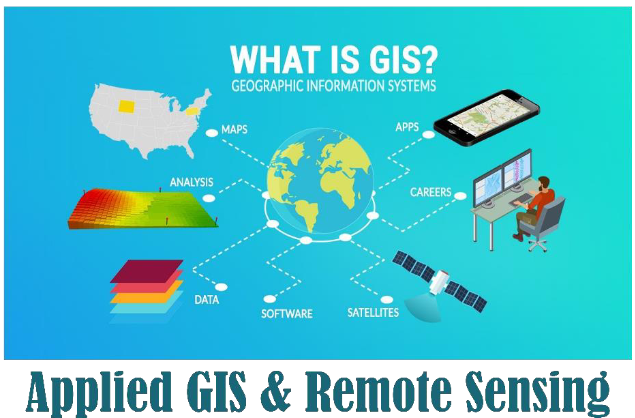
Name of Course: Applied GIS &Remote Sensing
Provided by: Ramakrishna Sarada Mission Vivekananda Vidyabhavan
Duration: 1 year-Total 180 Hours (2 hours per session)
Eligibility: Any Science-background student (Female students only)
Course Fee: – 20,000/- (10,000/half yearly)
Date of Commencement: January of Every Year
Classes will be held on: Saturday and Sunday (Tentative)
Mode: Blended Mode (Both online & offline)
About:
The Postgraduate Diploma in GIS and Remote Sensing is a nationally significant course that impacts the management of essential natural resources.
• The course covers the collection and analysis of geographical information data.
• This one-year PG Diploma is crucial for implementing government plans across various sectors, including agriculture, water resources, forestry, and ecology.
• The curriculum includes subjects such as agricultural science, geography, and satellite technology.
• The PG Diploma program equips candidates to research different geographical areas, collect and organize valuable data, and create maps with various angles and scales.
• GIS and Remote Sensing focus on gathering geographical data and securing it digitally.
• Students learn to monitor Earth’s surface events and obtain precise data on available natural resources.
Vision and Outlook:
• To provide foundational concepts and principles of Remote Sensing (RS) and GIS, along with their applications.
• To understand key GIS concepts and their application using Quantum GIS (QGIS), an open-source software package.
• To engage in interactive exercises with various ArcGIS tools, including ArcDesktop and ArcPro software.
• To learn to navigate Google Earth Pro, measure distances and areas, manage data, and create maps.
• To utilize drone technology and data processing with AGISoft.
• To conduct 2D and 3D computer-aided design using AutoCAD software.
Learning Outcomes:
GIS and Remote Sensing offer insights into the safety and security of infrastructures, allowing engineers to identify and address natural and human-caused threats. The visual information processed helps professionals observe changes in infrastructure and mitigate structural risks. Remote Sensing and GIS work together to gather, store, analyze, and visualize data from virtually any geographic location on Earth. Key applications include irrigation and soil moisture monitoring and management in agriculture. Developing skills in GIS can lead to diverse career paths in government, real estate, public health, crime mapping, landscape architecture, community planning, logistics, and more.
Key Benefits:
• Provides efficient data collection across various scales and resolutions.
• Enables faster data analysis compared to on-site collection methods.
• Offers extensive information from a single remotely sensed image, which can be used for multiple purposes.
Ayan Ghosh is a renowned IT professional specialising in GIS at the Special Investigation Division, CAD-GIS Centre, Public Health & Engineering Department, Government of West Bengal. In addition, Ayan Ghosh is a well-known name in GIS training. He has taught over a thousand students on various occasions. His unique teaching style and passion for GIS set him apart.
He has provided training on Remote Sensing and GIS to numerous academic and professional organisations, including the Civil Engineering Departments at Techno India College of Technology (Newtown and Batanagar), the Calcutta Institute of Engineering & Management GIS & GPS Department, the West Bengal Survey Institute, the Bandel Survey Engineering Department, the Technique Polytechnic Institution, the Hooghly Geography Department (PG) at Vivekananda College for Women, the Directorate of Distance Education at Behala, and the Geography Department at Vidyasagar University.
Currently, he has joined Ramakrishna Sarada Mission Vivekananda Vidyabhavan as a GIS and Remote Sensing faculty member.

Ms. Santana Debnath holds an M.Sc. degree in Geography with First Class honours from Calcutta University. She is NET qualified and has a PG Diploma in Geoinformatics. Additionally, she has completed diplomas in Tally and AutoCAD, as well as certificate courses in ArcGIS, QGIS, ERDAS, SPSS, Python, and several other software applications. She has also completed an internship programme.
Ms. Debnath has participated in and presented papers at one national seminar and six international seminars. She worked as a Climate Counsellor with ICCE to raise awareness about climate issues. Currently, she has joined Ramakrishna Sarada Mission Vivekananda Vidyabhavan as a GIS and Remote Sensing faculty member.

Ms. Pallabi Halder, Junior GIS Analyst, holds an M.A. degree in Geography from West Bengal State University (WBSU) and a PG Diploma in Geoinformatics from Jadavpur University. She is an experienced GIS Analyst with three years of experience working with UAVs, GIS, and LiDAR. Ms. Halder possesses strong skills in point cloud classification, feature extraction, design, analysis, development, and delivery, all aimed at enhancing business productivity.
She is currently working on ongoing projects including NKDA drone mapping and surveillance, CESC thermal data monitoring, and MLWB property surveys at Federal Synergies India Pvt. Ltd. She has recently joined Ramakrishna Sarada Mission Vivekananda Vidyabhavan as a GIS and Remote Sensing faculty member.
| SL No |
Name |
Download/ View |
| 1 |
Lesson Plan |
Click Here |
| SL No |
Name |
Download/ View |
| 1 |
Event Reports |
Click Here |
| SL No |
Name |
Download/ View |
| 1 |
Our Achievers |
Click Here |
| SL No |
Name |
Download/ View |
| 1 |
Career Benefits |
Click Here |
| SL No |
Name |
Download/ View |
| 1 |
Students Section |
Click Here |
| SL No |
Name |
Download/ View |
| 1 |
Testimonials |
Click Here |